Lac et Col de la Croix
Saint-Colomban-des-Villards


Presentation
At the foot of the Aiguilles de l’Argentière, this mountain hike leads to Lac de la Croix and the Col de la Croix through a spectacular mineral valley. A rewarding route offering remarkable views across the Belledonne range.
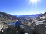
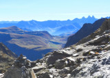
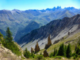
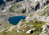
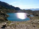
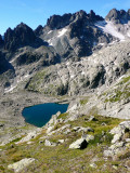
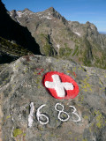
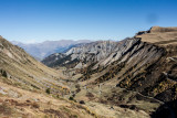
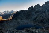
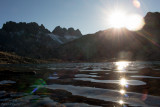
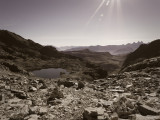
Starting from the Col du Glandon, this hike explores one of the most striking valleys in the Belledonne massif. After traversing the mountainside below the mountain huts near the pass, the trail gradually enters the Combe de la Croix, dominated by the impressive Aiguilles de l’Argentière and the cliffs of the Sambuis. The landscape becomes increasingly mineral as altitude is gained. The route then follows the stream through the valley towards a series of high-altitude plateaus where Lac de la Croix comes into view, nestled within a vast mountain cirque. The deep waters of the lake contrast beautifully with the surrounding rocky terrain, creating a landscape typical of the high mountains of Belledonne. A faint trail continues beyond the lake to the Col de la Croix at 2,529 metres, where wide-ranging views open onto the surrounding peaks. Near the pass, a carved boundary stone recalls the former border between Savoy and France, bearing a Savoy cross on one side and a fleur-de-lis on the other.
Safety information
This red-rated mountain hike is intended for hikers with experience of alpine terrain. Several sections cross rocky ground and scree slopes that can be tiring and occasionally unstable. Good physical fitness, suitable footwear and careful footing are recommended. As with any high-altitude hike, weather and ground conditions should be checked before setting out.
Période(s) d'ouvertureFrom 15/05 to 01/12 daily.
Download
Contact
Lac et Col de la Croix
Saint Colomban des Villards / Col du Glandon
73130
Saint-Colomban-des-Villards
In Short
- Section :
- Sport
- Levels of sporting experience :
- Level red – hard
- Route :
- Distance (km) 8.8
- Daily duration (minutes) 300
- Elevation (m) 600
- VillageDeDepart :
- Saint-Colomban-des-Villards
Informations
- Natures terrain :
- Ground
- Stone
- Pedestrian sports :
- Pedestrian sports
- Hiking itinerary
Equipments, Services
- Services :
- Pets welcome
Good to know
- Indication prix :
- Gratuit
- Sitra promotion typology :
- Open air
Prices
| Fares | Min | Max |
|---|---|---|
| Free | ||
Destination
Lac et Col de la Croix
Saint Colomban des Villards / Col du Glandon
73130
Saint-Colomban-des-Villards
GPS coordinates
Latitude : 45.239598
Longitude : 6.175504