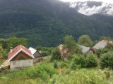
Le Monthyon (1079m)
Saint-Alban-des-Villards

Presentation
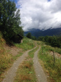
Start: Premier Villard hamlet, at the start of the forest track of Nant.
Descriptive: At the first bund, continue to the right path which lead to the Reisses valley (follow the sign “viabilité incertaine”). After crossing the Bacheux torrent, reach the Monthyon hamlet.
Période(s) d'ouvertureFrom 15/05 to 01/12 daily.
Contact
Le Monthyon (1079m)
73130
Saint-Alban-des-Villards
In Short
- Section :
- Sport
- Levels of sporting experience :
- Level green –very easy
- Route :
- Distance (km) 2.7
- Daily duration (minutes) 120
- Elevation (m) 150
- VillageDeDepart :
- Saint-Alban-des-Villards
Informations
- Natures terrain :
- Ground
- Pedestrian sports :
- Pedestrian sports
- Hiking itinerary
Equipments, Services
- Services :
- Pets welcome
Good to know
- Sitra promotion typology :
- Open air
Destination
Le Monthyon (1079m)
73130
Saint-Alban-des-Villards
GPS coordinates
Latitude : 45.316611
Longitude : 6.260512